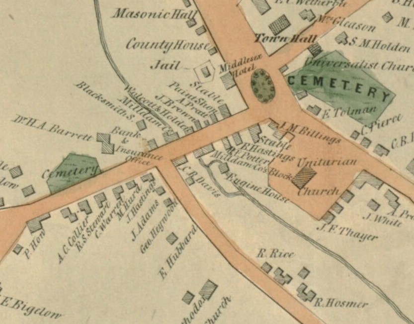
Detail of 1852 Walling Map of Concord
Title
Detail of 1852 Walling Map of Concord
Subject
Anderson Market Exhibit
Description
This detail of the 1852 Walling map shows the structure on the north side of the Mill Dam now called the Anderson Market building.
Image description: A color map of the Milldam area with roads highlighted in red and green spaces in green. Each business along Main Street is labeled, as well as the Town House, Middlesex Hotel, Unitarian Church (First Parish), and other well-known landmarks.
Image description: A color map of the Milldam area with roads highlighted in red and green spaces in green. Each business along Main Street is labeled, as well as the Town House, Middlesex Hotel, Unitarian Church (First Parish), and other well-known landmarks.
Rights
William Munroe Special Collections, The Concord Free Public Library
Publisher
William Munroe Special Collections, The Concord Free Public Library
Date
1852
Format
jpeg
Language
English
Type
image
Files
Citation
“Detail of 1852 Walling Map of Concord,” William Munroe Special Collections at the Concord Free Public Library, accessed July 19, 2026, https://sc.concordlibrary.org/items/show/4970.